The Michinoku Shiokaze Trail is a trail that runs the entire length of the Sanriku Fukko National Park. It extends roughly 1000km, running from Hachinohe City to Soma City in Fukushima Prefecture. This long walking trail is one of the best ways for visitors to take in the view of nature and civilization existing together, as well as the lifestyle and culture of the Tohoku region. If 1,000 km is a little too long a commitment, see the (much shorter) sample itinerary below. It covers some of the trail’s best views along the Tanesashi Coast, all within a day.
Itinerary
Start at Kabushima
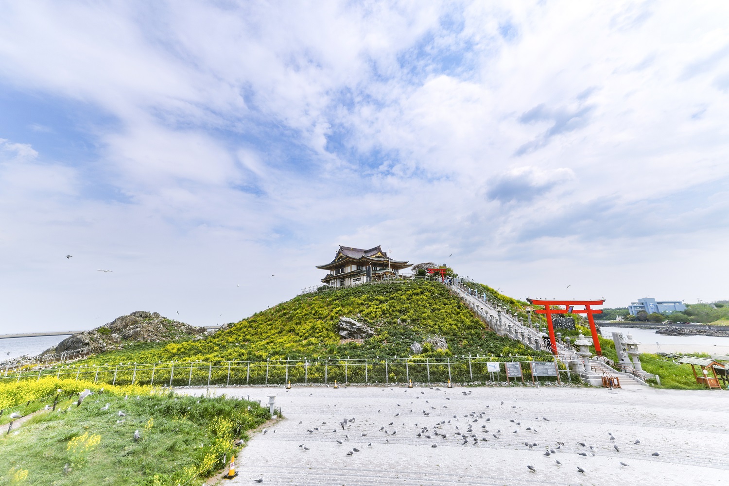
This is the only place in Japan where you can observe the breeding of black-tailed gulls at close range. This is also the starting point of the Michinoku Shiokaze Trail.
Hachinohe City Marine Science Museum(Marient)

Ashigezaki Scenic Overlook
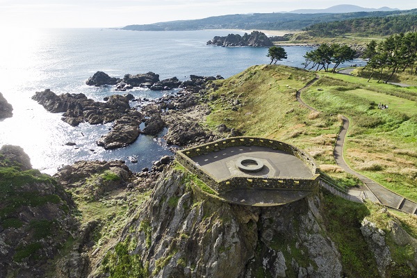
This historic scenic overlook was used as a military facility during WWII. Grab an ice cream at the cafe next to it and continue down the walking trail.
Nakasuka

Nakasuka is one of the most beautiful spots on the coast, and it is also referred to as “Hana no Nagisa” (Shore of Flowers). Here, not only beautiful seaside plants but alpine flora too bloom all along the walking trail.
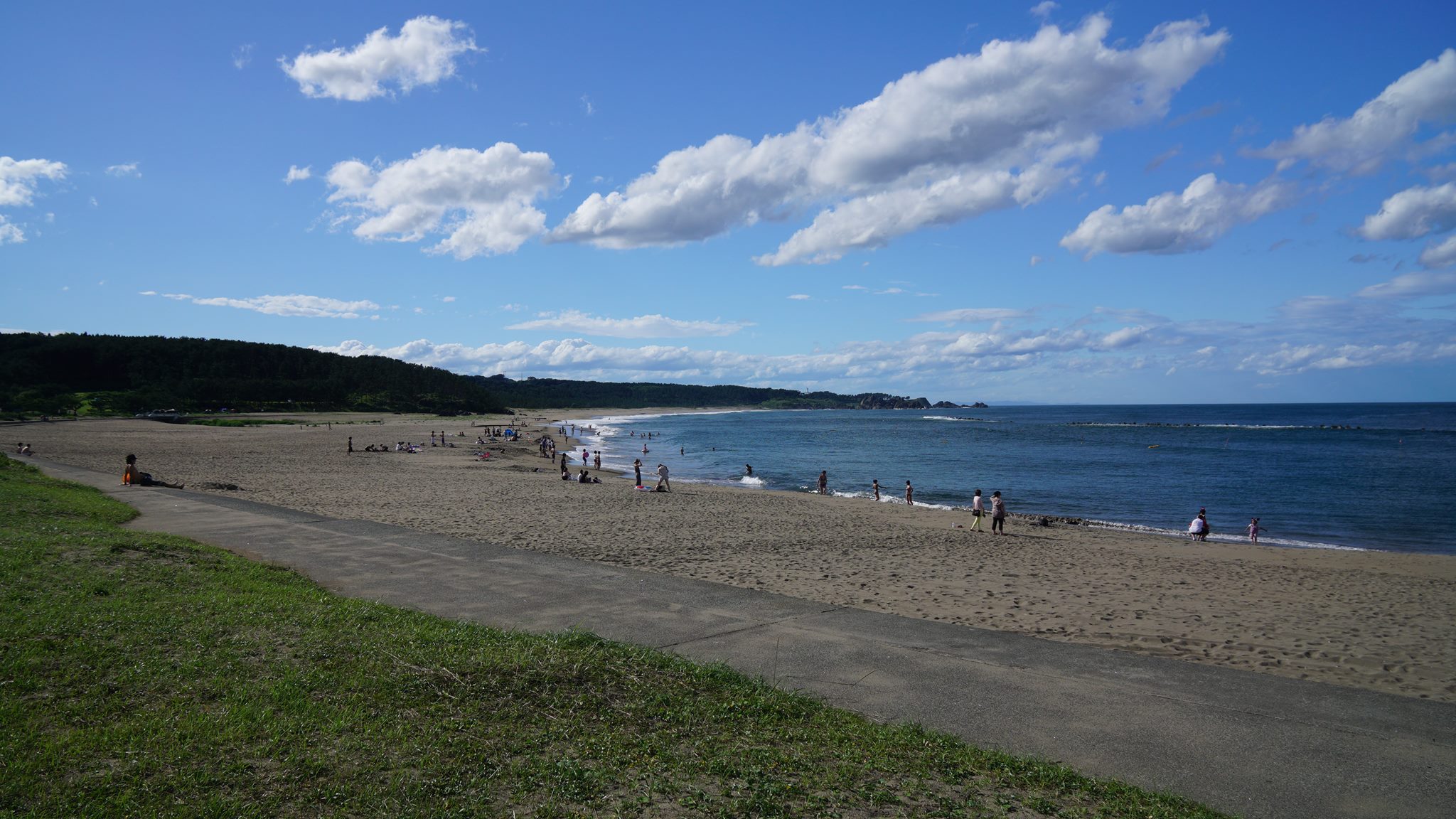
Osuka Beach

This long stretch of beach features “singing sand”, sand that seems to sing or squeak when you step on it. But don’t be fooled by the beauty of the beach, this is one of the hardest parts of the trail as the long stretch of sand makes for slow going.
Shirahama Beach
This beach lays adjacent to the Osuka beach and is a great place for swimming during summer.
Shiraiwa / Fukakubo Fishing Port
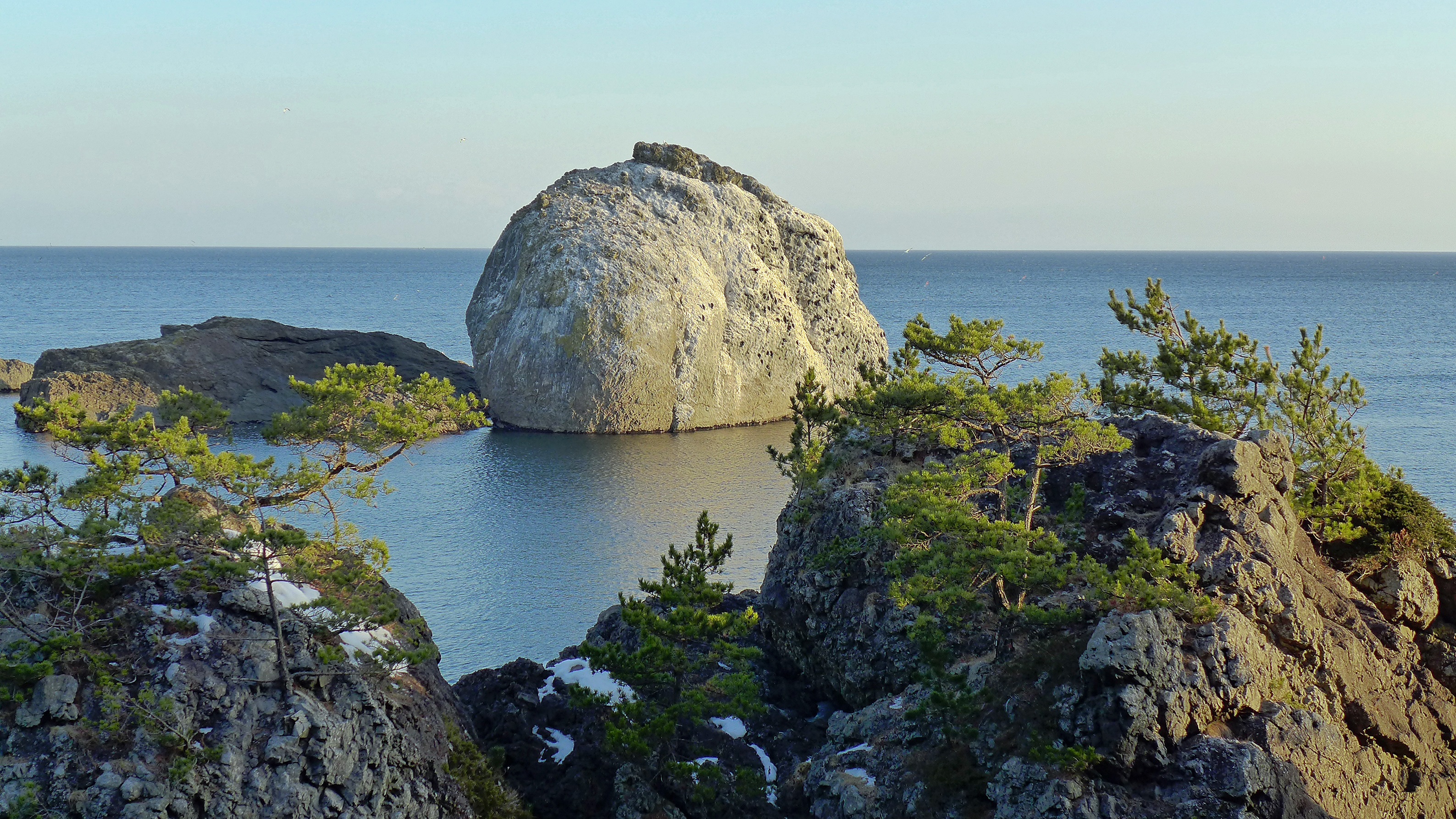
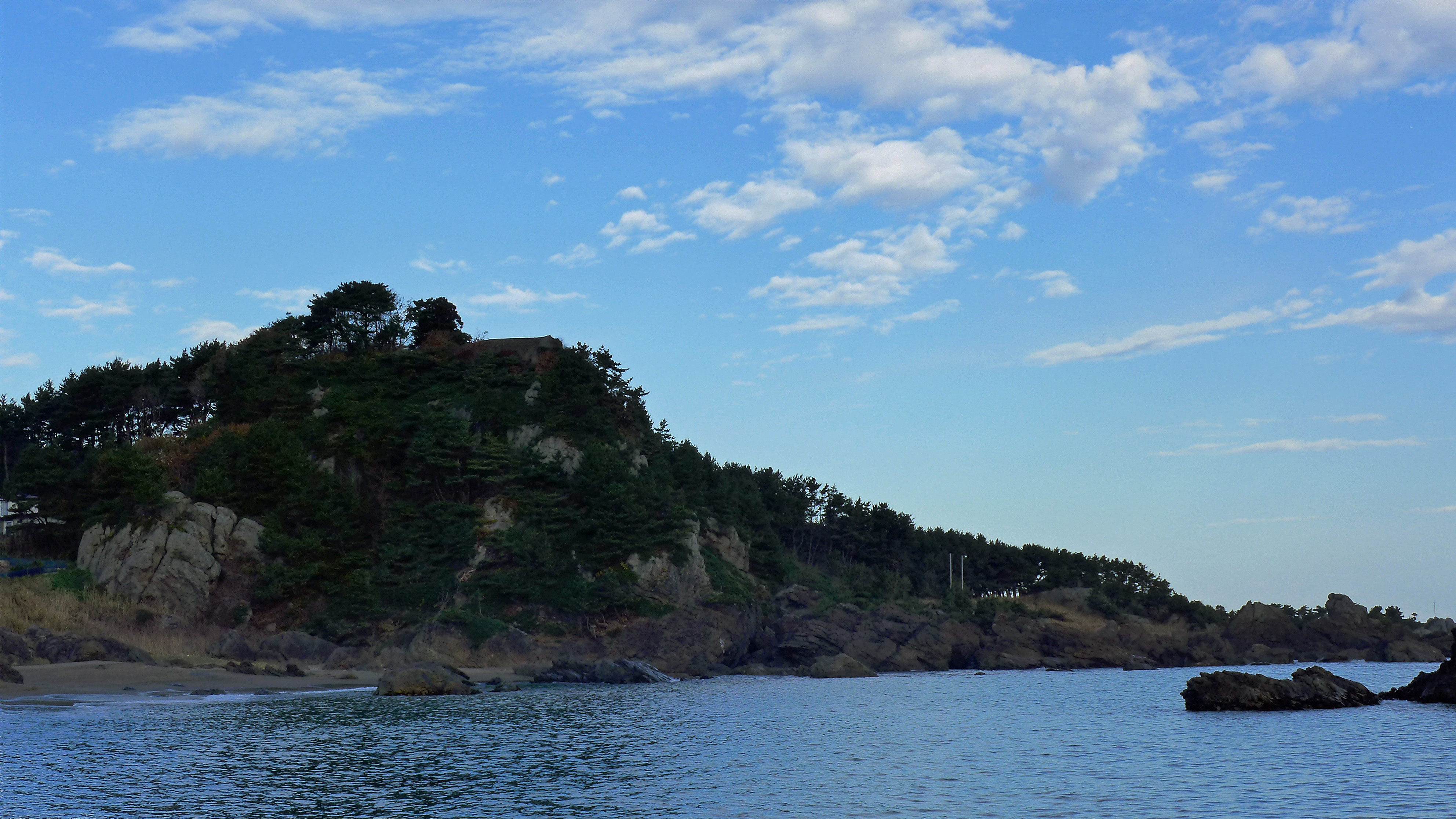
As the trail passes through the Fukakubo Fishing Port the Shiraiwa, or white rock, will begin to come into view. Enjoy the beautiful white boulder from the trail, a site that cannot be seen by those who choose to drive along the coast rather than walk.
The Yodo Pine Grove

This is a pine forest with trees that are nearly 100 years old. Walk along the hilly walking trail while taking in the view of the beautiful ocean peeking through the pine trees.
Tanesashi Natural Lawn
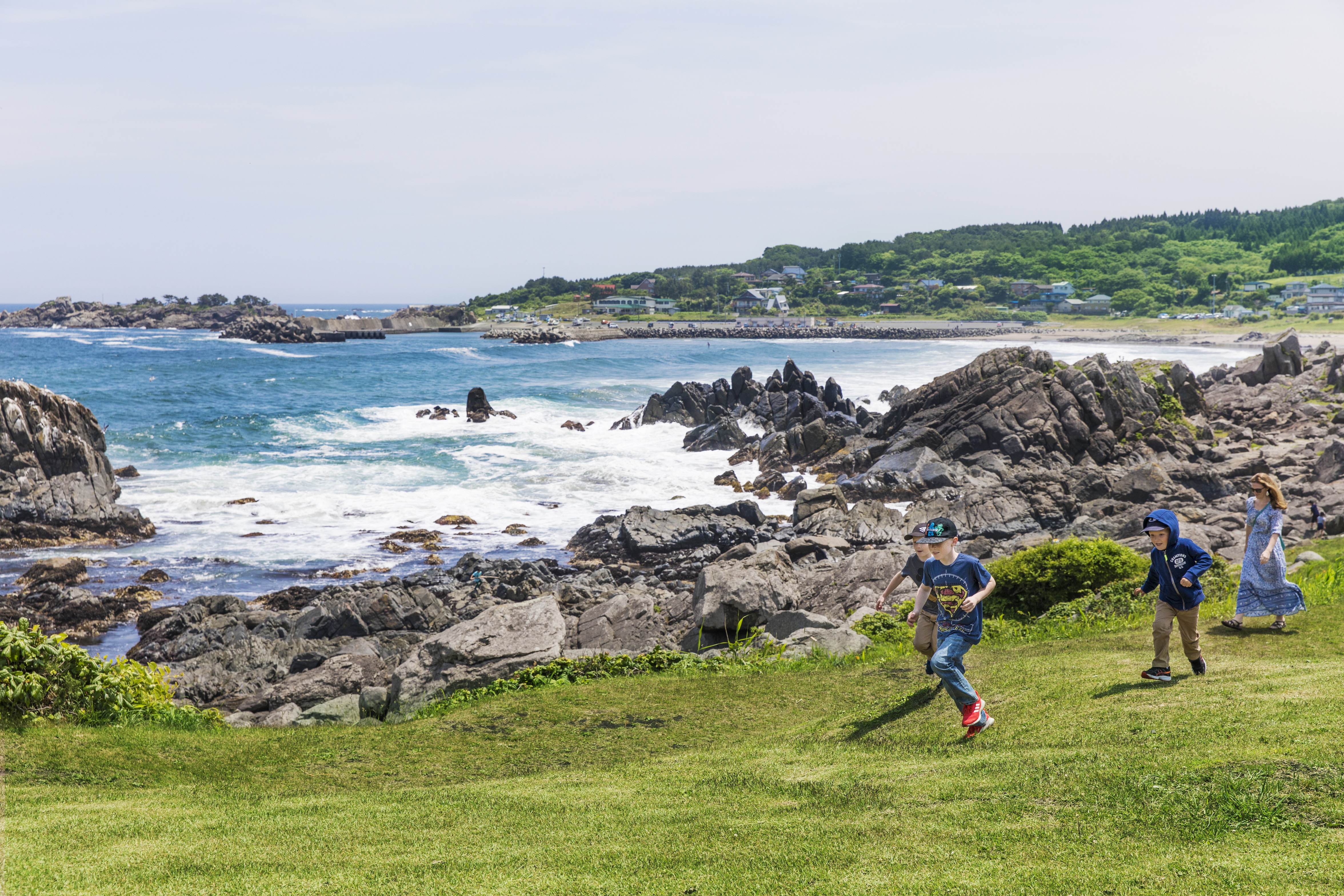
If you make your way through Yodo no Matsubara, an expanse of greenery will spread out before your eyes. Relax from your journey here while taking in the spectacular view.
Takaiwa Overlook
This observation deck is located at the highest point along the Tanesashi Coast. The trail offers the chance to stop by the best-kept-secret scenic spots.
Hamagoya (Fishing Tools & Beach Hut)
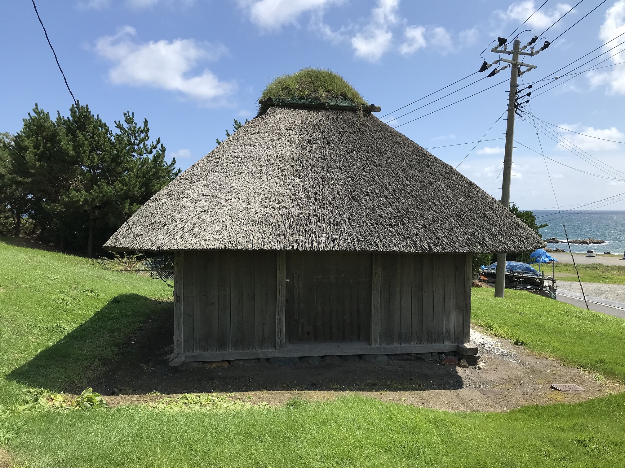
This thatched-roof hut, where you can get a sense of the fishing industry and lifestyle of old Hachinohe, has been designated a national important tangible folk cultural property. Please inquire about tours (Hachinohe City Museum).
Hashikami Coast

Situated at the most southeastern portion of Aomori, the town of Hashikami is known to be ‘the first to see the sunrise’ in the prefecture. Enjoy camping, gathering seashells and more on the beautiful Hashikami Coast.
Mt. Hashikami
Mt. Hashikami is 740m tall and called the ‘sleeping cow mountain’ by the locals. It is a popular spot for hiking, birdwatching, wild vegetable, and herb picking, and is well known for the rhododendrons that bloom on it during the spring. Its summit affords a tremendous view, which you can see the surrounding coastline up to the Shimokita peninsula, the sprawling form of Hachinohe city, and even and the Iwate mountain ranges.